
 Deutsch
 English
 Русский
 Українська
 Español
 Français
 한국어
한국어
 中文
中文
 Български
 Română
 Ελληνικά
 हिन्दी
 Indonesia
 Italiano
 日本語
日本語
 Melayu
 Nederlands
 Norsk
Norsk
 Polski
 Português
 Српски
 Svenska
 العربية
 فارسی
فارسی
 Bosanski
 Shqip
Shqip

Den Augenblick nutzen.
Reisen, die Sie lieben werden, genießen Sie es, weg zu sein!
Beliebte Aktivitäten

Kayseri-Kappadokien Privater Flughafentransfer
75 Minute
Startpreis
65 €
%13 Rabatt

Nevsehir-Kappadokien Privater Flughafentransfer
45 Minute
Startpreis
50 €
%9 Rabatt
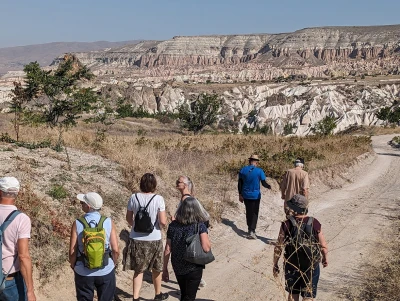
Wandern in Kappadokien mit garantierter Durchführung ab 2 Teilnehmern

5 Nacht 6 Tage
Startpreis
450 €
%18 Rabatt
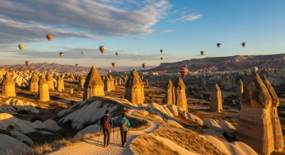
Ihr persönliches Kappadokien-Erlebnis in 2 Tagen
1 Nacht 2 Tage
Startpreis
175 €
%13 Rabatt
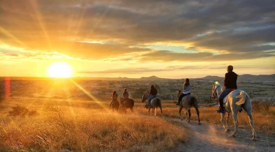
Reitsafari in kappadokische Täler
2 Stunde
Startpreis
40 €
%11 Rabatt

Kunden-Kommentare
Die Tour durch Kappadokien war absolut fantastisch! Wir haben uns in die atemberaubenden Landschaften verliebt. Die Vielfalt der Farben und Formen der...
Die zweitägige tour war absolut fantaztisch. Ich habe viele verschiedende Sehenswürdighkeiten gesehen und das Highlight waren definitiv die Heißluftba...
Das war einfach unglaublich! Die 2-tägigen Erkundung durch die Lanschaften und Kultur in der Umgebung hat meine Erwartungen total übertroffen. Wir sin...
Ich habe kürzlich eine wunderbare Tour in der atemberaubenden Landschaft erlebt. Die Höhlen waren unglaublich faszinierend, und die Ballonfahrt am Mor...
Wow, was für ein Abenteuer! Ich war total begeistert von dieser zwei-Tage Tour. Kappadokien ist unglaublich schön mit seine ungewöhnlichen Felsformati...
Eine der schönsten Naturlandschaften der Welt mit ihrer einzigartigen Felsformation wie in Kappadokien konnte nur durch eine wunderschöne Wanderung un...